File:1715 De L'Isle Map of the Eastern Roman Empire under Constantine (Asia Minor, Black Sea, Balkans) - Geographicus - ImperiiOrientalis-delisle-1715.jpg
Jump to navigation
Jump to search

Size of this preview: 800 × 597 pixels. Other resolutions: 320 × 239 pixels | 640 × 477 pixels | 1,024 × 764 pixels | 1,280 × 955 pixels | 2,560 × 1,910 pixels | 5,000 × 3,730 pixels.
Original file (5,000 × 3,730 pixels, file size: 5.85 MB, MIME type: image/jpeg)
Captions
Captions
Add a one-line explanation of what this file represents
| Title |
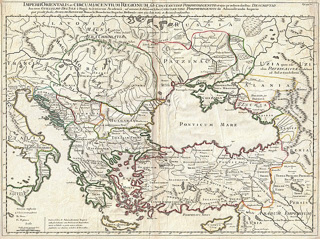
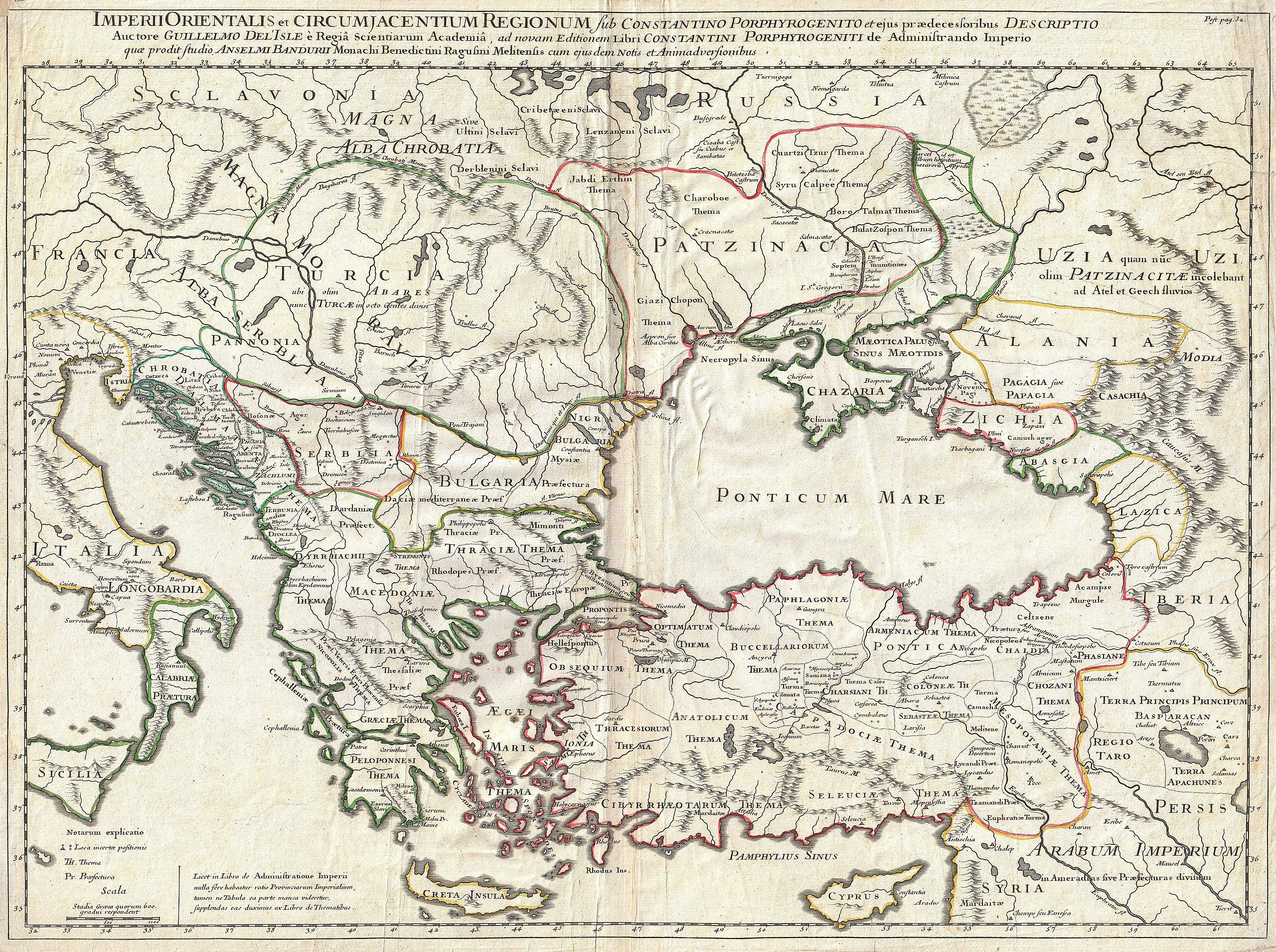
Imperii Orientalis et Circumjacentium Regionum, sub Constantino Porphyrogenito et ejus praedecessoribus descriptio. Auctore Guillelmo Del'Isle e Regia Scientiarum Academia, ad novam editionem Libri Constantini Porphyrogeniti de Administrando Imperio quae prodit studio Anselmi Bandurii, Monachi Benedictini Ragusini Melitensis cum ejus dem note et animadversionibus. |
|||||||||||||||||||||||
| Description |
English: A very attractive c. 1715 example of Guillaume De L’Isle’s map of the Eastern Roman Empire under Constantine (c. 330 AD). Depicts from eastern Italy and Sicily eastwards as far as the Black Sea, and modern day Armenia. Includes Crete, Cyprus, all of the Balkans, and parts of Russia. Offers wonderful detail with historical notes, cities and topographical elements shown in profile, and historical notes where appropriate. Prepared as plate 32 for De L’Isle’s 1718 reissue of his important Atlas de Geographie . |
|||||||||||||||||||||||
| Date | (undated) | |||||||||||||||||||||||
| Source |
De L'Isle, Guillaume, Atlas de Geographie. (probabally the 1718 issue).
|
|||||||||||||||||||||||
| Creator |
|
|||||||||||||||||||||||
| Permission (Reusing this file) |
|
|||||||||||||||||||||||
| Geotemporal data | ||||||||||||||||||||||||
| Bounding box |
|
|||||||||||||||||||||||
| Georeferencing | ||||||||||||||||||||||||
| Archival data | ||||||||||||||||||||||||
| Accession number |
Geographicus link: ImperiiOrientalis-delisle-1715 |
|||||||||||||||||||||||
| Dimensions | height: 19 in (48.2 cm); width: 24.5 in (62.2 cm) | |||||||||||||||||||||||

File history
Click on a date/time to view the file as it appeared at that time.
| Date/Time | Thumbnail | Dimensions | User | Comment | |
|---|---|---|---|---|---|
| current | 17:38, 22 March 2011 | | 5,000 × 3,730 (5.85 MB) | BotMultichillT (talk | contribs) | {{subst:User:Multichill/Geographicus |link=http://www.geographicus.com/P/AntiqueMap/ImperiiOrientalis-delisle-1715 |product_name=1715 De L'Isle Map of the Eastern Roman Empire under Constantine (Asia Minor, Black Sea, Balkans) |map_title=Imperii Orientali |
You cannot overwrite this file.
File usage on Commons
The following page uses this file:
_-_Geographicus_-_ImperiiOrientalis-delisle-1715.jpg&oldid=752865731)